Re-imagining the role of offices in a post-pandemic world through mobility data
Meta Design Lab, Singapore University of Technology and Design
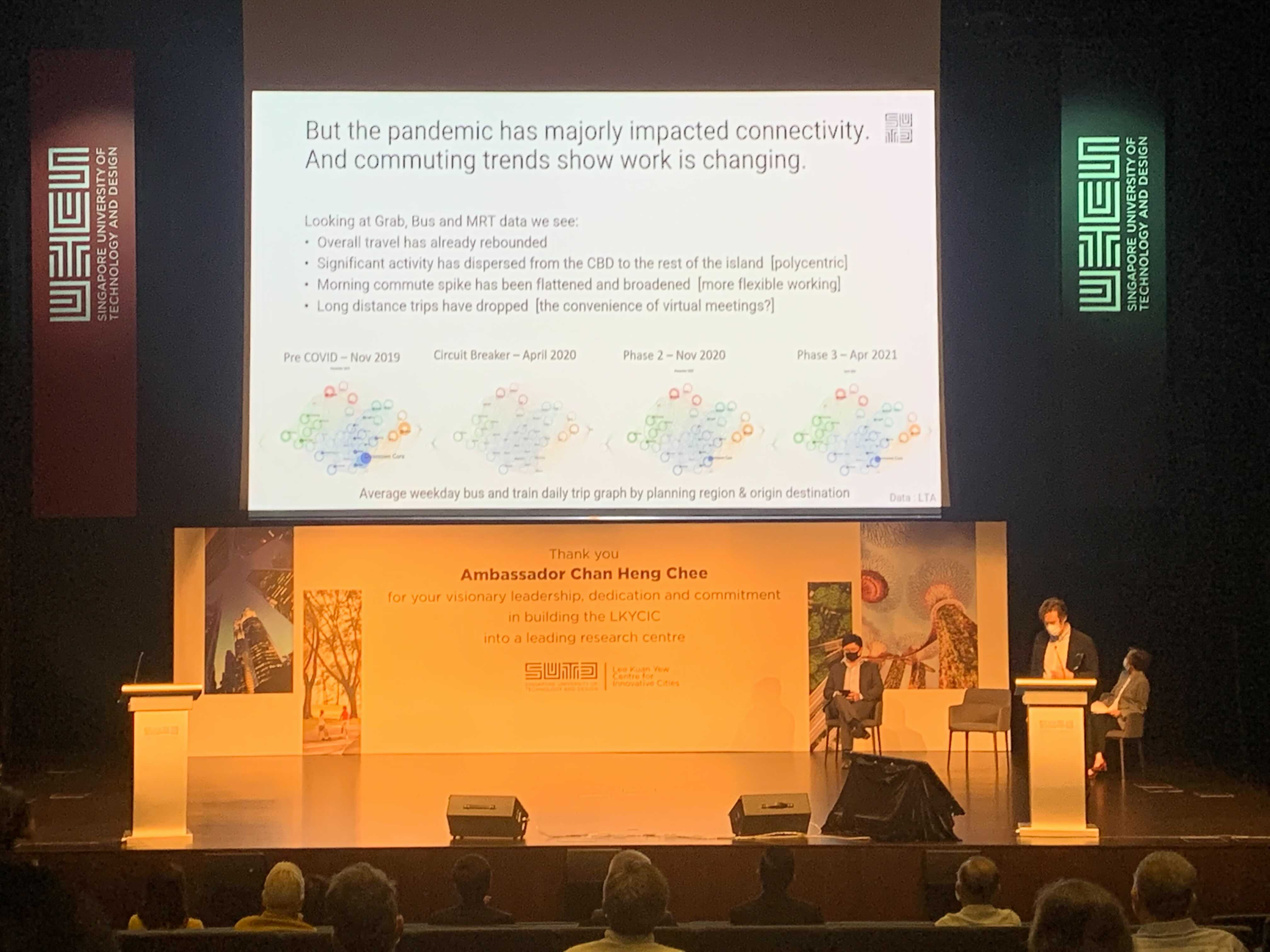
What might offices look like after COVID19? Given changing expectations about the line between places where we live, work and play, it’s highligh likely new typologies of work will rise in popularity. We investigated mobility data as a proxy for office use to understand how much travel was happening between outer zones of Singapore (typically residential) and business districts such as the city centre, Queenstown and Tampines.
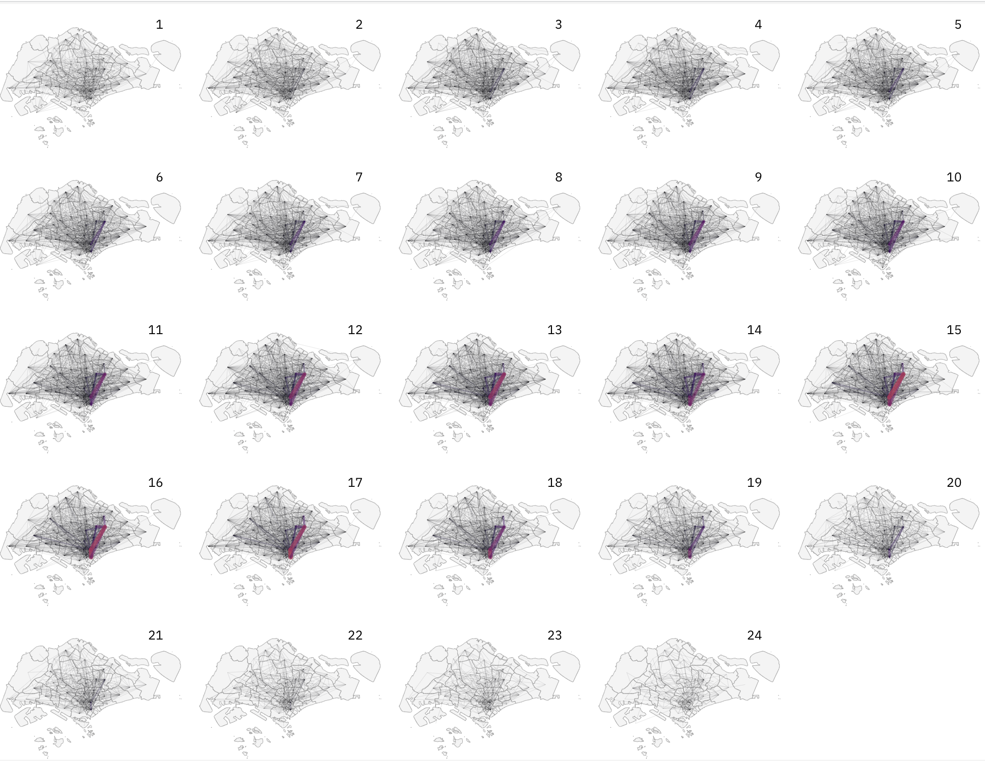
This project is an ongoing investigation into how mobility patterns were impacted by COVID19 and resulted in new micro-mobility patterns that could serve as the basis for future transport demand in poly centric cities. Inspired by Markov chains (left), I created a data visualization that would capture inflows, outflows and internal flows between and within planning regions, zones and sub zones in Singapore all in one graphic. I am investigating how transport networks and behavioural patterns